Adelaide's best walking trails rated by distance and difficulty: from flat beach strolls to hill climbs
Whether you have 30 minutes or half a day, the city's outdoor fitness network has a trail to match your legs.
Whether you have 30 minutes or half a day, the city's outdoor fitness network has a trail to match your legs.

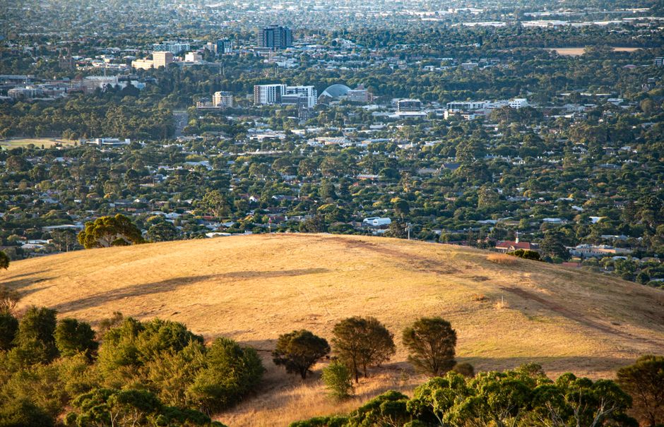
Adelaide has more than 700 kilometres of dedicated walking and cycling paths within the greater metropolitan area, yet most residents still circle the same two or three routes. A closer look at what's actually out there — rated honestly by distance and effort — shows the city punches well above its weight for trail variety.
Mid-winter is when this matters most. Gym memberships spike in January and quietly lapse by March, but sports medicine practitioners at clinics along Greenhill Road consistently report that outdoor movement sustained through winter produces better long-term fitness outcomes than indoor-only routines. With July temperatures sitting between 8°C and 16°C this week — cool enough to push hard without overheating — conditions for trail walking are close to ideal. Anyone managing a specific health condition should check with their GP before ramping up intensity.
The Glenelg foreshore path is the obvious starting point for beginners. The sealed track runs 4.2 kilometres from the Holdfast Shores marina north to the West Beach caravan park boundary, entirely flat, with water bubblers every 800 metres or so and café stops on Jetty Road for a post-walk long black. Dogs on leads are welcome on most sections before 10am. Difficulty: 1 out of 5.
Step up slightly and the Adelaide Parklands inner ring — the looped path encircling the CBD between Glover Avenue and Botanic Road — covers roughly 8.5 kilometres. Terrain is grass and compacted gravel. The Botanic Gardens parkrun uses a 5-kilometre segment of this network every Saturday morning at 8am, free to register through the national parkrun website. More than 400 runners and walkers showed up to the Botanic Gardens event on the last Saturday in June, organisers confirmed via their results page — a record winter turnout for that venue. Difficulty: 2 out of 5.
The Adelaide Central Market on Gouger Street is worth mentioning here not as a trail but as a provisioning stop: walkers doing a longer urban loop through the CBD and Parklands can grab fresh fruit, nuts, and the city's best falafel roll for under $12, all within 200 metres of the Morphett Street footbridge.
The Adelaide Linear Park is the city's most underused asset. The full trail runs 50 kilometres along the Torrens River from the mouth at West Beach all the way to Gumeracha in the Adelaide Hills. Most casual walkers tackle the 12-kilometre central section between the Torrens Weir at Thebarton and the Athelstone trailhead — well-marked, mostly shaded, and passable in trail runners or decent sneakers. Difficulty: 2 to 3 out of 5 depending on section.
For something genuinely demanding, the Waterfall Gully to Mount Lofty Summit track in the eastern suburbs is the benchmark. The route from the Waterfall Gully Road carpark climbs 432 metres over 3.7 kilometres one way. The South Australian government's Trails SA database lists it as Grade 4 — suitable for experienced walkers with appropriate footwear. Expect the return trip to take 2.5 to 3.5 hours. The carpark on Waterfall Gully Road fills by 8am on weekends in winter, so arriving early is not optional advice, it's practical necessity.
Slightly less brutal but equally scenic is the Hallett Cove Boardwalk in the southern suburbs, a 4.6-kilometre loop through a conservation park that contains some of the best-preserved glacial geology in the Southern Hemisphere. The route drops to the beach and climbs back through scrubland. Flinders Chase National Park, for those prepared to travel two hours to Kangaroo Island, offers the Ravine des Casoars Hike at 21 kilometres — genuinely remote and rated Grade 5.
The practical advice is simple: start with the Glenelg flat or the Botanic Gardens loop this weekend, add the Linear Park central section by the end of July, and plan the Waterfall Gully climb for August once your base fitness is built. Download the free Trails SA app, check the Bureau of Meteorology forecast the night before, carry at least 500ml of water even on cold days, and tell someone where you're going on any route beyond Grade 3. Adelaide's trail network rewards the methodical.
Partner Content
PromotedTell your story in long form alongside trusted local journalism. Native placements run for seven days across the homepage and a dedicated article URL, with a clear “Promoted” label and full editorial production support.
Enquire about partner contentSpread the word
About this article
Published by The Daily Adelaide
Your take
Daily brief
Free, in your inbox before 7am. Weekdays.
More from Adelaide